
China’s public transportation system is one of the most extensive and efficient in the world,covering everything from subways and buses to high-speed trains and light rail. But for foreign travelers, navigating these systems can be confusing without a clear understanding of how to read the maps. China public transportation maps are visually dense, often bilingual, and designed for high-volume daily use.
What do the colors and numbers mean on China transit maps
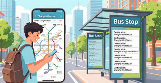
Most public transportation maps in China use color-coded lines for subway systems. For example, in Beijing, Line 1 is dark red and Line 2 is blue. These colors are consistent across stations, apps, and printed maps. Each line also has a number, and the direction is indicated by the terminal station names. Buses use a different system: route numbers like 300 or 运通101. These numbers are shown on the front and side of the bus, and the stops are listed in both Chinese and pinyin. Some maps also include QR codes that link to real-time updates.

Where to find English-friendly China public transportation maps
The best place to find usable maps is inside subway stations. Every station has a large wall map with English names. Apps like MetroMan and Baidu Maps also offer downloadable versions. For buses, Google Maps is less reliable in China. Instead, use Apple Maps or the Chinese app 高德地图 (Gaode). These apps show bus routes, arrival times, and transfer points in English. Airport and train station information desks also hand out paper maps. If you are in a smaller city, ask your hotel for a printed transit guide.
How to plan a route using China public transportation maps
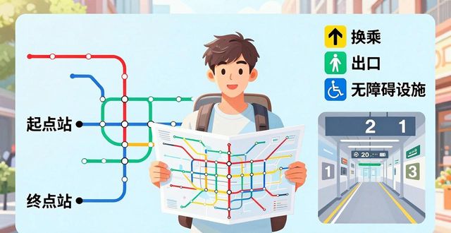
Start by identifying your current station and your destination station on the map. Note the line color and direction. Most maps have a legend that explains symbols for transfers, exits, and accessibility. For longer trips, look for interchange stations marked with a circle or a white number. These are where you switch lines. Always check the last train time posted at the station entrance. Some lines close earlier than others. Write down the station name in Chinese characters as well—this helps when asking for directions or showing a taxi driver.
Why digital maps are better than paper ones in urban China
Digital maps update in real time. They show delays, closures, and crowded train cars. Apps like Alipay and WeChat have built-in transit map features. You can scan a QR code at the turnstile to enter the subway without buying a ticket. Digital maps also calculate the fastest route and estimate travel time. For visitors who do not speak Mandarin, digital maps with voice navigation in English are a huge help. Paper maps are useful as a backup, but they can be outdated or hard to fold.
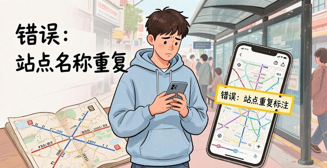
Common mistakes when reading China public transportation maps
One common mistake is confusing the direction of a subway line. Trains run in two directions, and the map shows both terminal stations. Always check which terminal is closest to your destination. Another mistake is ignoring the transfer stations. Some transfers require walking long distances underground. Maps do not always show this clearly. Bus maps can be misleading because bus stops may have different names going in opposite directions. Always double-check the stop name and the bus number before boarding.
China public transportation maps are powerful tools once you understand their logic. They combine multiple layers of data into one visual system. With a little practice, you can move through any Chinese city with confidence.